Posts

Showing posts from January, 2022

Brighton and The English Channel
Image
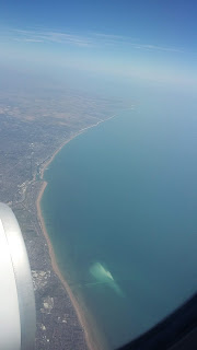
Brighton is located directly south of London and is officially a city (designated in 2000). Brighton and Hove (the name of the city) is located on the English Channel with a very long coastal path which varies in width along its length. Brighton is relatively easy to access, despite the nearest motorway being the M23 more than 15 miles away. As the A23 provides good access to the north and the A27 to the east and west. Brighton is also easy to access by train with the Brighton main line ending at Brighton from central London. Brighton is also served by the east and west coastway lines which provide access to other towns along the coast. Brighton Pavilion Constituency

Cavalry Tunnel: The Secret Almost Abandoned Tunnel under a London Railway Line

Image
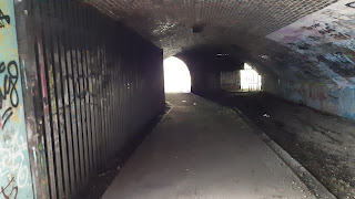
Nowhere to be found on Google Maps, running parallel to the River Crane, the Cavalry Tunnel lies dark and abandoned under the train line between Whitton and Feltham. And despite the unclear access rights the tunnel is relatively heavily used by the general public with no physical obstructions which stop access. The tunnel is split into two parts; the most used paved section connecting either side of the train line, and the abandoned pitch black fly tipper's heaven with a tantalising door at the end. The Used Section Despite being almost abandoned the used section has unnaturally high footfall primarily because the nearest crossing of the railway line is 0.6 miles away (by the c

The Views of London

Image
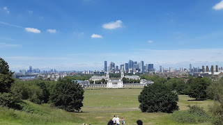
London is a beautiful city with many buildings and constructions of interest. And whilst the architecture of the city may look good up close, nothing beats a phenomenal view of the London skyline that incorporates many landmarks. Different people like different views and whether you want to be able to see a specific building or prefer having a narrow or wide field of view, going to the right viewpoint is vital to maximise your journey. The viewpoints discussed will be from various locations in (and sometimes just out) of London. I have included GPS coordinates for each and a description of roughly where each viewpoint is. These views are not in any o

BedZED

Image
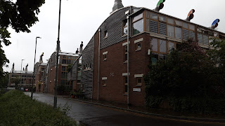
Beddington Zero (fossil) Energy Development, opened in 2002, was the first large scale development of its kind in the UK. The mixed-use sustainable community prides itself on being extremely environmentally friendly, with buildings designed and constructed to reduce energy consumption as much as possible. This means the area has various built-in enhancements to reduce carbon usage. Location BedZED is located in Hackbridge, South London (near Beddington) and is surrounded by unremarkable housing. Whilst it is only a few hundred metres from Hackbridge station the local connections at BedZED make

Crossrail Place and Canary Wharf (Elizabeth Line)

Image
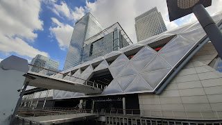
The Elizabeth Line is officially opening in the “first half of 2022” with Canary Wharf (Elizabeth Line) a brand new station. Currently it is rumoured that the Elizabeth Line (between Paddington and Abbey Wood) might open on 6th March 2022 (I don't have the answer to whether that will actually happen). And despite the actual station not being open Crossrail Place is an integral part of Canary Wharf. Crossrail Place Crossrail Place is the above ground section of the complete Elizabeth Line station Canary Wharf. Partly opened in May 2015, Crossrail Place facilitates many high e

The Surrey Hills

Image
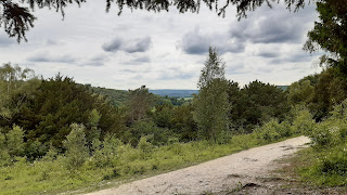
The Surrey hills are a series of hills (quite tall hills but still hills) to the south of London. In general the northern flanks of these hills rise sharply but steadily and the southern flanks are much more marked and steep. The diesel-only Guildford to Three Bridges train line runs just to the south of these hills, on much flatter ground. And there are a few lines running through the hills north to south, including the Brighton main line and the Leatherhead to Horsham line. These lines have to be specially designed to account for the terrain and have sections of tunnel which navigate the tracks through the hills. Box Hill

The Thames Barrier

Image
The Thames Barrier is really a series of individually controllable barriers opened in 1982 which collectively protect London from the water of the Thames. The amounts of water have increased a lot in its years of operation primarily due to climate change with the barrier being forecast to be obsolete by 2070. It is an interesting and vital piece of infrastructure which protects London (especially central and other low lying areas). When Closures Happen The Thames barrier closes when a particularly high tide is forecast. This could be because of a large storm heading towards London or perhaps be

London City Airport

Image
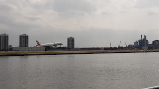
Located in the Docklands and far too close to far too many things, Greater London’s second airport is much smaller than Heathrow. City Airport is so small numerous operating constraints are needed which makes the airport fascinating. There is only a single runway, located on a leftover dock turned brownfield site after the docks demise, with the airport opening in 1987. The dock is only wide enough for the actual runway so it also doubles as a taxiway so planes (depending on how the airport is being operated) might have to taxi along the full length of the runway before turning around and taking off. London City Airport now has a station on the DLR (opened in 2005 along with the extension to King George V) with the station having one exit to the airp

London’s (now second) Newest River Pier, Royal Wharf Pier

Image
Royal Wharf could really be anywhere, but this new pier is in the Docklands, just west of London City Airport, and placed, like all Uber Boat piers, on the Thames. The pier lies just west of the Thames barrier and on the Thames’ northern shore, and is extended rather far into the River. To the east the River Bus stop is Woolwich and to the west it is North Greenwich for the O2. Royal Wharf opened late in 2019 and is only served at peak times on weekdays, but at weekends it has an all day service. This pier connects the newly developed masses of flats in the local area to the city. The timetable suggests Royal Wharf Pier was primarily built to serve commuters working in central London, this is much like the weekday peak hours services to and from Putney.

The Ribblehead Viaduct

Image
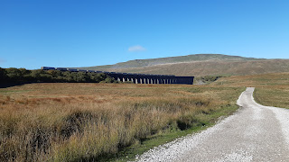
One of the many freight trains crossing the viaduct The Ribblehead Viaduct is on the astoundingly beautiful Settle and Carlisle line. The line travels through the Yorkshire Dales National Park navigating its way through the hills and valleys, and because of these large changes in elevation this viaduct, along with many others, are needed. The Ribblehead Viaduct is one o

The Northern Line Extension

Image
The extension to the Northern Line, which opened on 20 September 2021, serves two new stations, Nine Elms and Battersea Power Station. It was the first extension to the London Underground since 2008 when the Underground made it to Heathrow Terminal 5. And with the current funding issues facing TFL no new extensions to the Underground are currently being built with the Bakerloo Line extension to Lewisham and possibly beyond now not thought to be constructed before 2030. Noti

New Year's Resolutions

Image
It's the 4th of January 2022 and if you set a new year's resolution (something I feel is getting less and less common) you have most likely broken it. And if you've broken your resolution, which happens to basically 99% of resolutions set, then they are waiting a whole year to try and keep another one next year. When you only give yourself a couple days a year to change for the better then, I believe, it is inevitable that most people fail their resolution and don't make a change in their life for the better.